
Story and photos by Cheryl Hartz
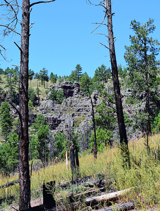
Arizona sites devastated by wildfires are widespread and vast. Yet, Mother Nature continually heals herself through a progression of changing vegetation patterns. Kendrick Mountain near Flagstaff illustrates this natural progression after being devastated by not one, but two major fires this century.
Lightning caused both fires, which without the staffed fire lookout in place since early 1900, could have been even worse.
In the 6,664-acre Kendrick Mountain Wilderness, designated in 1964, the 10,418-foot elevation Kendrick Peak lies in the San Francisco mountain volcanic field on the Coconino Plateau of the Kaibab National Forest. The Wilderness also extends into the Coconino National Forest.
The Pumpkin Fire started May 24, 2000, and burned 14,760 acres, ravaging the majority of the wilderness over two weeks. It was contained by June 9, but continued to burn within containment lines until finally extinguished by monsoons in late August. Firefighters were able to save the lookout tower and historic 1912 lookout cabin.
The Boundary Fire burned 17,788 acres from June 1 to July 3 in 2017. Extreme drought conditions, high temperatures and strong winds contributed to both blazes.
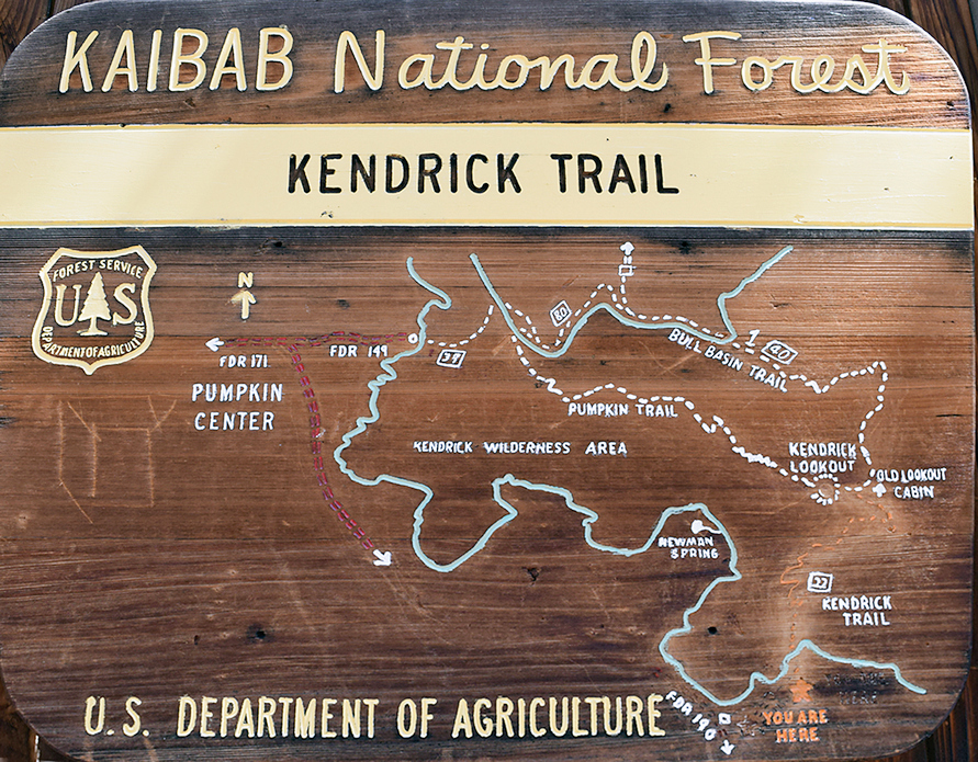
These fires caused closure of the mountain’s three maintained trails encompassing 14 miles and leading to the top of Kendrick Mountain, where the fire lookout tower stands.
Kendrick Mountain Trail No.22 is 9.2 miles roundtrip. It boasts one of the highest vistas in the state, with views of the Grand Canyon, Oak Creek Canyon and Bill Williams Mountain.
Bull Basin Trail No. 40 is a 9-mile roundtrip. Old Kendrick Lookout Cabin, built in the 1900s and on the National Register of Historic Places, is along this trail.
Pumpkin Trail No. 39 is 9.6 miles roundtrip and passes an old sheepherder cabin. Using the Connector Trail, you can link up with Bull Basin for an 11-mile hike.
The three trails are open now but fire caused the volcanic soil to become unstable, so severe erosion occurred on trails and the steepest slopes. All trails are rated challenging because of elevation gains and the wildfire of erosion and falling dead trees.
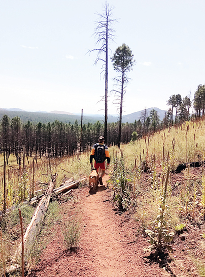
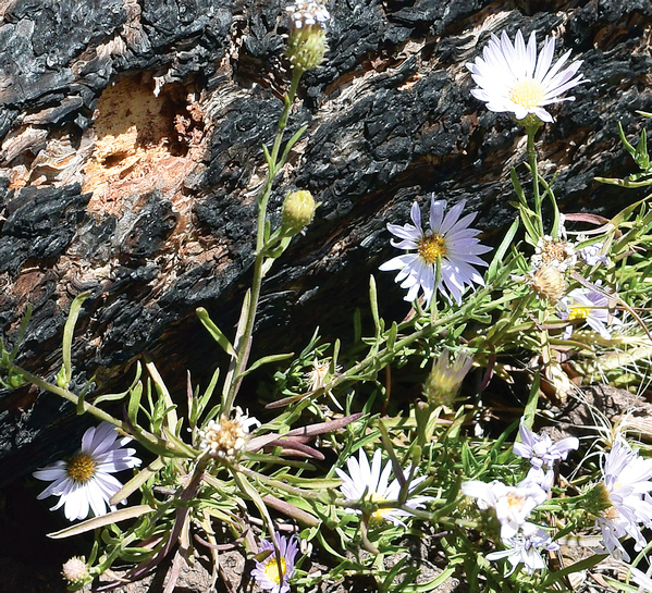
Ponderosa pines to mixed conifers still dot the area, and wildflowers pop up in unexpected spots – to the eye’s delight. A wide variety of birds, reptiles and mammals live in the rather harsh conditions.
The mountain continues to recover. Forest aging is called succession, as the plants modify their environment. The most severely burned sections become populated with early seral species. Grasses and shrubs establish first in open areas and enrich the soil as they die and fertilize the ground.
Eventually, young coniferous and deciduous trees again can move in. Once shade returns, shade tolerant species can establish. The forests, aspen and mountain meadows will recover with the passage of decades.
A designated wilderness, this area and its trails are closed to motorize vehicles and bicycles. With the posted lookout’s permission, visitors usually are welcome to climb the tower when it is open during the summer.
Because there is a 6-mile stretch of dirt road to the trailheads on FR 245 after turning off Highway 180, 4-wheel drive vehicles may be required at times. Usually passenger vehicles suffice.
As of early June, fire danger was very high and Stage 1 restrictions were in effect, meaning no campfires or charcoal, and no smoking outside of vehicles. Unless Arizona’s monsoons return, Stage 2 or even 3 (closure) could be implemented. Check online or with the Flagstaff Ranger District, (928) 526-0866.
Happy hiking on this resilient mountain!